There are various kinds of maps in the field of geography and cartography, including general reference maps, thematic maps, physical maps, political maps, and topographic maps. However, an OldMapster topographic map is among the most useful maps that visualize the earth’s topography or relief.
Topographic maps might seem difficult and overwhelming to understand at one glance since there seems to be a lot of information that should be taken in all at once. However, it doesn’t need to be the case in the first place.
Table of Contents:
What are Topographic Maps?
Before you start exploring topographic maps, the first thing you should do is to understand what these maps are all about. Generally speaking, topographic maps are large-scale maps depicting both the manmade and physical features of a landscape.
These maps are also uniquely characterized by the use of contour lines showing the land’s ground relief exhaustively. Most manmade features can also be seen in topographic maps including roads, railroads, towns, vegetation types, elevation, mountains, and rivers.
How Do You Use Topographic Maps?
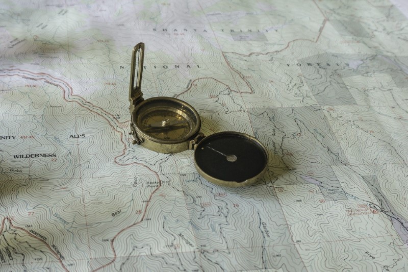
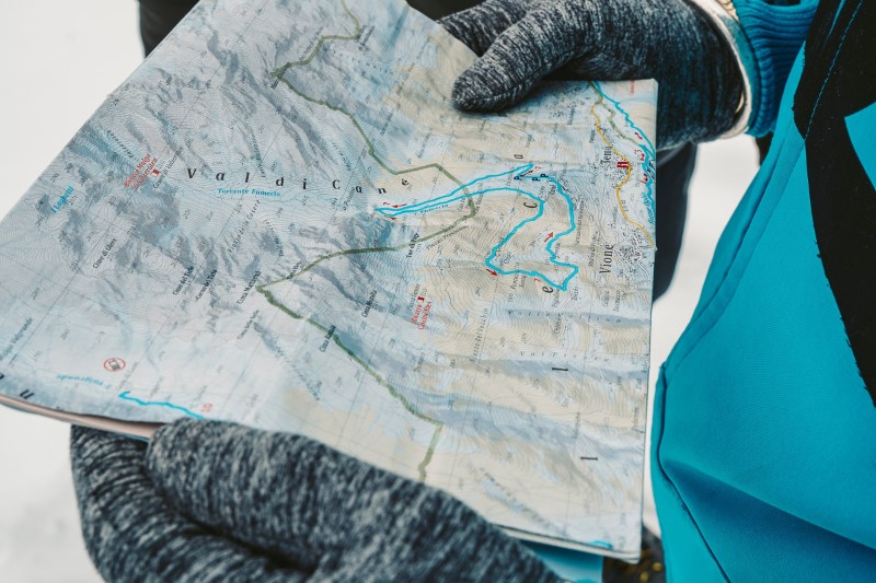
While it is handy to know the features generally found on topographic maps, the actual skill that you would want to learn is how to understand what these maps show you. It is an invaluable skill that lets you on adventures into the unknown with just a paper map on hand and the confidence of finding your way through unfamiliar terrain in a safe way.
Topographic maps have four primary features that you should master and be familiar with and these are contour lines, colors and shading, map scales, and general map features and details.
Contour lines
Contour lines are what set topographic maps apart from other maps. Understanding these contour lines and their functions is of extreme importance if you want to learn how to read topographic maps. These contour lines let you visualize the 3D world on 2D map then pinpoint particular landscape features like valleys, mountains, slopes, hills, spurs, and ridges. It is an important skill required every time you use a topographic map for navigating in the wilderness or places where there are no identifiable manmade features.
These contour lines are lines on a map joining points of the same height above sea level that allows an easy and simple visual representation of steepness of slopes, height of mountains, and a general sense of a terrain. The contour lines’ shape is an essential piece of information that lets you pinpoint features on a map like valleys, passes, ridges, or peaks. Circular shapes that are smaller most like show you hills or peaks, while V-shapes probably show you a ridge or spur.
Rapid changes in elevation and slope steepness are indicated by the closeness of the contour lines to each other. The contour lines are closer together if the slope is steeper. It is important to note that the contour numbers read in uphill direction, meaning the highest number indicates the hilltop while the smallest number indicates the land’s lowest point.
There are also set intervals in contour lines at 20m, 10m, or 5m that depends on the map’s scale. Contour intervals imply an elevation change from a contour line to another and will always stay the same in the map. These contour intervals are often indicated in the legend of the map. Not all contour lines are labeled. Only every 5th contour line is labeled on majority of topographic maps called Index Contours and are shown on the map as something bolder compared to the rest of the contours.
General map features and details
The map legend lets you unlock topographic maps as this gives you every piece of information you will need to decipher the meaning of each color and symbol found on the map. Knowing the meaning of the symbols on the map lets you get a better understanding of your surroundings every time you use a topographic map.
Map scales
Map scales are very important features on topographic maps. A map scale is the ratio between the distance on the man and its corresponding distance on ground. There are various map scales with a large-scale map covering the small areas in extensive detail while a small-scale one covers larger areas with minimal detail.
There are various ways of representing the scales of maps and the three most common ones include the following:
- Bar scale – A bar scale visually depicts the relationship between the distances in the real world and the map.
- Verbal scale – This scale gives details on the relationship between the measurements in the real world and the map.
- Fraction scale – It is a ratio that indicates one unit of measurement on the map is equivalent to 50,000 units in the real-world.
Shading and Colors
The use of colors in a topographic map plays an important role in providing context to the map as well as its different features. There are specific colors given to each feature while shading is being used for indicating the different types of landscapes that can be found in the area of the map.
Brown is the color used for indicating contour lines. Meanwhile, green is being used for showing vegetation. Water features like rivers or lakes are indicated by blue while red and black are used to pertain to different manmade features like administrative boundaries or roads.
What are the Different Uses of Topographic Maps?
Topographic maps now come in handy in a plethora of uses and purposes in this modern day and age, from recreational uses like trekking and hiking to more specialized fields like surveying and civil engineering. Many people encounter or even use these topographic maps themselves in their recreational activities, such as when planning their trip to the back-country or wilderness or when trying to find their way around areas of wilderness.
You see, a topographic map doesn’t have to be too complicated. So, the next time you feel the need to go on an adventure, don’t be afraid to explore the world with the help of topographic maps!
Posts from the same category:
- Different types of maps
- Zadar Wedding Photography
- What to Expect from a Harmonica School
- Dream Wedding Venues in Slovenia


